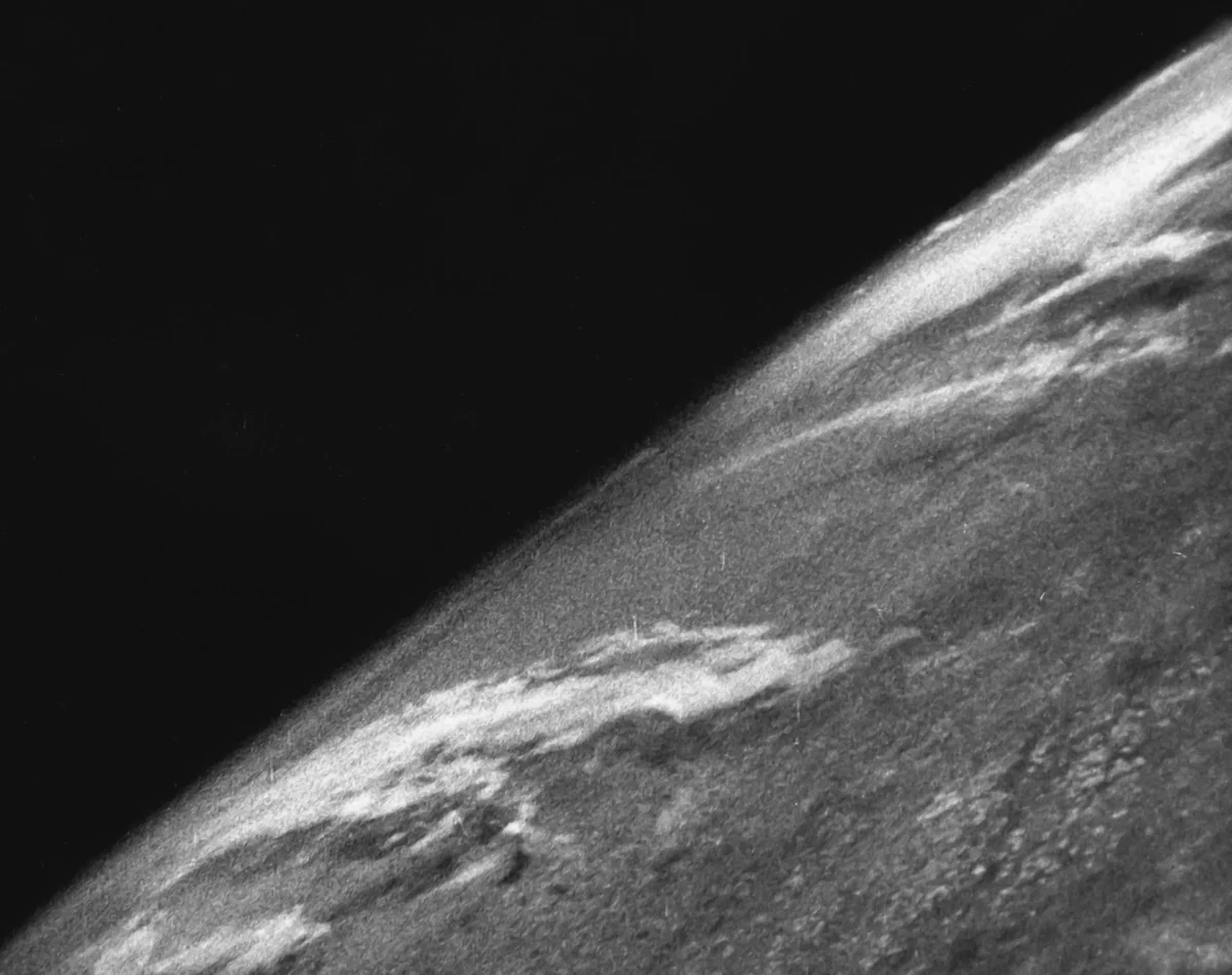
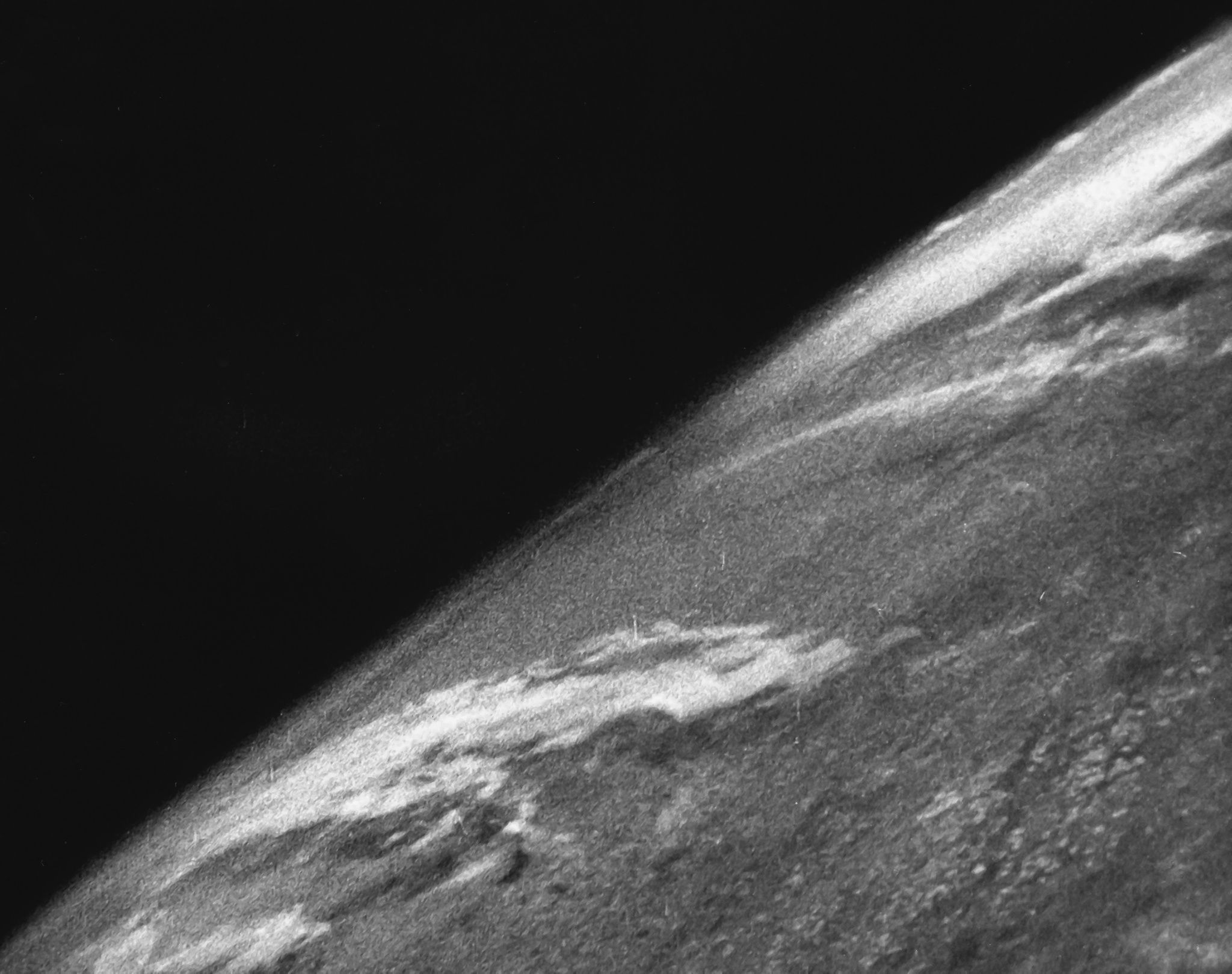
On October 24, 1946, the trajectory of human perspective shifted permanently when a U.S. Army V-2 rocket, launched from the White Sands Missile Range in New Mexico, captured the first-ever photograph of Earth from the edge of space. While the resulting imagery—grainy, black-and-white, and fragmented—would appear unremarkable by modern high-definition standards, the technical achievement marked a seminal moment in 20th-century history. For the first time, humanity had physically transcended the atmosphere to look back at its own cradle, setting the stage for the space race and the eventual development of modern satellite surveillance and Earth observation science.
The Technological Genesis: Adapting War Technology for Science
The V-2 rocket, or Vergeltungswaffe 2 (Retaliation Weapon 2), was originally engineered by Nazi Germany during the Second World War as the world’s first long-range guided ballistic missile. Following the collapse of the Third Reich, the United States initiated Operation Paperclip, a secret program that brought German scientists—including Wernher von Braun—and captured rocket components to the United States.
The launch at White Sands was not intended as a propaganda tool or a grand exploration mission, but rather a rigorous scientific experiment. Researchers at the Applied Physics Laboratory in Maryland and other academic institutions sought to use these surplus rockets as high-altitude platforms for cosmic ray and meteorological research. By retrofitting the warhead sections of these missiles, engineers replaced explosive payloads with heavy-duty cameras, sensors, and protective equipment.
The camera utilized for this historic flight was a 35-millimeter motion picture camera, mounted within the rocket’s nose. It was programmed to snap a new frame every 1.5 seconds as the rocket ascended. Achieving this required immense engineering precision; the camera had to survive the intense vibrations of the rocket’s takeoff and the extreme temperatures of the upper atmosphere, all while maintaining functionality in a vacuum.
Chronology of the Flight: From Launch to Impact
The launch sequence began in the early morning hours of October 24, 1946. As the liquid-propellant rocket ignited, it generated roughly 56,000 pounds of thrust, pushing the vehicle into the New Mexico sky. The rocket reached an altitude of approximately 65 miles—well above the Karman line, the internationally recognized boundary of space, which lies at 62 miles (100 kilometers).
For several minutes, the rocket carved a path through the stratosphere and into the thin, dark expanse of space. As it reached its apogee and began its descent, the camera continued its rhythmic firing, capturing the curvature of the Earth against the absolute blackness of the void.
The flight concluded with a violent return. Lacking a recovery parachute system, the V-2 rocket plummeted back toward the desert floor, striking the Earth at a velocity of roughly 340 miles per hour. The impact was catastrophic for the vehicle; the rocket and the camera itself were effectively obliterated upon contact with the arid New Mexico soil. However, the film had been encased within a specialized steel housing designed to withstand the high-velocity impact.
When the recovery team reached the crash site, they found the steel container amidst the wreckage. Upon processing the film, the scientists were reportedly stunned by what they saw. Historical accounts from the era describe the team members jumping and cheering, fully aware that they had witnessed a view of the world that no human—and no device—had ever seen before.
Supporting Data and Technical Specifications
To understand the magnitude of this achievement, one must consider the limitations of mid-1940s technology. The V-2 was fueled by a mixture of ethanol and liquid oxygen, a volatile combination that required constant monitoring. The altitude of 65 miles placed the rocket beyond 99% of the Earth’s atmosphere, effectively removing the interference of weather and thick air that had previously obscured high-altitude photography from weather balloons.
The images provided a resolution that, while primitive, allowed for the identification of massive cloud formations and the distinct separation between the Earth’s surface and the horizon. This data was crucial for meteorologists, who were suddenly able to visualize the movement of weather systems from a top-down perspective, a concept that was previously purely theoretical.
Official Responses and Scientific Impact
At the time, the U.S. military maintained strict control over the images. However, the academic community quickly recognized the implications. In the immediate aftermath, the photos were circulated among researchers who used them to study the composition of the upper atmosphere and the intensity of solar radiation at higher altitudes.
While the primary interest of the military was the development of ballistic missile technology, the "spin-off" benefits of the V-2 program were profound. The success of the October 24 flight provided the empirical evidence needed to secure further funding for space-based research. Within a few short years, the focus shifted from simple photography to the development of dedicated scientific payloads, leading directly to the creation of the National Aeronautics and Space Administration (NASA) in 1958.
The Birth of the Environmental Perspective
Beyond the technical milestones, the 1946 photograph initiated a psychological shift that would take decades to fully manifest. By visualizing the Earth as a singular entity floating in a dark vacuum, the image laid the groundwork for the modern environmental movement.

This perspective was later crystallized during the Apollo era, particularly with the "Blue Marble" photograph taken by the crew of Apollo 17 in 1972. However, the roots of this "overview effect"—the cognitive shift reported by astronauts when viewing Earth from space—can be traced back to the grainy frames of the V-2 rocket. It was the first time humanity realized the planet was not an infinite expanse, but a finite, fragile sphere.
Implications for Modern Reconnaissance and Global Observation
The evolution from that single 35mm camera to modern satellite constellations represents one of the most significant technological progressions in history. Today, reconnaissance from space is the backbone of global security and intelligence, utilizing multispectral imaging and synthetic aperture radar to monitor everything from military movements to the health of the Earth’s rainforests.
Furthermore, the meteorological data provided by current satellite arrays—descendants of those early V-2 efforts—saves thousands of lives annually by providing early warnings for hurricanes, typhoons, and other extreme weather events. The agricultural sector also relies heavily on these tools to monitor crop yields, soil moisture, and deforestation rates, effectively turning the Earth into a managed, observed system.
Conclusion: A Legacy of Discovery
The October 24, 1946, mission remains a cornerstone of the space age. It proved that space was accessible, that data could be gathered from the void, and that our perspective of the home planet could be irrevocably altered by a single frame of film. The men who drove into the desert to retrieve that steel canister were not just recovering lost data; they were bringing back a piece of the future.
As we continue to push further into the solar system, with plans for lunar bases and human missions to Mars, the legacy of that first V-2 launch serves as a reminder of the power of exploration. What began as a military exercise in the aftermath of a global conflict transformed into a scientific endeavor that defined the 20th century and continues to shape our understanding of our place in the universe. The grainy images from 1946 were the first, but they opened a window that humanity has never since chosen to close.