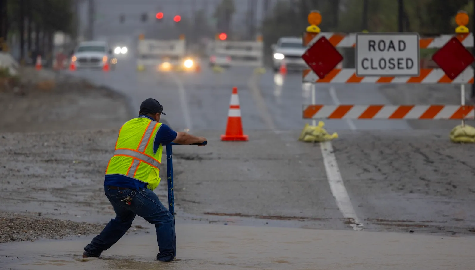
LOS ANGELES — In a state historically defined by scorching sun-baked valleys and the relentless anxiety of wildfire seasons, a deeply unusual and paradoxical sense of dread has taken hold this autumn: the arrival of rain. While precipitation is universally recognized as a life-giving resource critical for agricultural productivity and human survival, the current atmospheric conditions carrying it to the Pacific Coast are nothing short of monumental. Driven by the strongest El Niño event ever scientifically recorded, the arrival of heavy downpours has transformed a traditionally celebrated seasonal shift into a high-stakes race against catastrophic flooding, debris flows, and infrastructural strain.
For California, the psychological and physical burden of water is deeply complex. The state has long suffered from what hydrologists and climate scientists describe as "weather whiplash"—a volatile pendulum swinging violently between prolonged, multi-year megadroughts and intense, concentrated deluges. As global temperatures rise and the atmosphere retains unprecedented levels of moisture, the historical baseline for weather patterns has fundamentally shifted. Rather than rejecting the rainfall, state agencies, local municipalities, and environmental scientists are engaged in a massive, statewide paradigm shift: rewriting how California collects, stores, and utilizes water to build long-term climate resilience.
The Chronology of Crisis: Echoes of Past Catastrophes
To understand the current urgency among California’s water managers, one must look backward through the state’s volatile meteorological history. El Niño phenomena are periodic climate patterns characterized by warming surface waters in the central and eastern tropical Pacific Ocean, frequently triggering extreme weather deviations across the globe. In California, historic El Niños have consistently served as harbingers of destruction.
The benchmark for modern devastation remains the monstrous El Niño winter of 1997 and 1998. During that period, relentless atmospheric rivers battered the state, triggering widespread, catastrophic flooding, massive landslides, and destructive debris flows composed not merely of water and mud, but of massive boulders and uprooted timber. Infrastructure failed under the immense strain, property damage soared into the billions, and dozens of residents lost their lives.
Subsequent decades have repeatedly tested the state’s emergency response systems, most notably during the winter of 2017, when heavy rainfall nearly compromised the spillways of the Oroville Dam, forcing the emergency evacuation of nearly 200,000 residents downstream. These events scarred public consciousness and underscored a stark reality: California’s twentieth-century water infrastructure—built largely for a predictable Mediterranean climate that no longer exists—is ill-equipped to handle the ferocious, concentrated precipitation of the twenty-first century.
The Mechanics of Saturation: Why Timing and Intensity Matter
The threat facing California is twofold, defined not only by the sheer volume of water falling from the sky, but precisely how and when it arrives. Water behaves according to the laws of physics—it is heavy, dynamic, and requires immense energy to channel through pumps or direct via gravity.
When a single large storm hits the state, soils can absorb a significant percentage of the precipitation, buffering the immediate runoff. However, when a rapid succession of atmospheric rivers rolls ashore in a relentless convoy, the ground rapidly reaches total saturation.
"Even one storm can be very big and impactful," explains Steven Springhorn, a supervising engineering geologist in the California Department of Water Resources’ sustainable groundwater management office. "But if they start to come in a series, that’s where you start to get into some situations where you have a lot of excess water."
This sequential bombardment creates severe logistical hurdles for the state’s nearly 1,500 engineered surface reservoirs. Designed primarily to capture snowmelt and spring runoff gradually, these dams possess finite storage capacities. During exceptionally wet winters, operators are frequently forced to execute emergency releases of water from swollen reservoirs to prevent catastrophic overtopping or structural failure. Consequently, millions of acre-feet of potentially valuable water bypass containment entirely, rushing uselessly past urban centers and out into the Pacific Ocean.
Turning Liabilities into Assets: The Underground Renaissance
Faced with the limitations of surface dams—which also carry severe environmental consequences, such as blocking the migration routes of endangered Pacific salmon—California has increasingly turned its gaze downward, looking to its sprawling subterranean aquifers for salvation.
For generations, the state extracted groundwater at unsustainable rates, particularly during periods of severe drought. This over-pumping has been acutely catastrophic in the agricultural heartland of the Central Valley, where subterranean water tables have dropped precipitously. The withdrawal has caused severe land subsidence, with parts of the San Joaquin Valley sinking by nearly 30 feet as underground clay layers collapse like empty plastic bottles.
Yet, this ecological crisis presents a profound structural opportunity. While California’s major surface reservoirs possess a combined storage capacity of roughly 21 million acre-feet (an acre-foot being the volume of water required to cover one acre of land to a depth of one foot), the state’s subterranean basins hold an estimated storage potential of nearly one billion acre-feet, according to Michael Kiparsky, director of the Wheeler Water Institute at the University of California, Berkeley.
"So the potential room for storage is immense," Kiparsky notes. "The enticing question is: Is there a way to grab those flood flows before they flow out to sea, and hold them underground, and therefore expand our capacity?"
To answer that question, state and local water agencies have increasingly embraced a strategy known as managed aquifer recharge (MAR). Rather than rushing stormwater away from populated areas through concrete channels, water districts are actively diverting excess runoff into expansive, unpaved basins—often referred to as spreading grounds—where the liquid can slow down, pool, and naturally percolate into the underlying earth.
When regional spreading grounds reach capacity, local authorities coordinate directly with agricultural growers. Farmers are enlisted to flood their dormant crop fields intentionally, utilizing agricultural acreage as temporary infiltration basins. This subsurface storage yields a double benefit: not only does it replenish depleted aquifers—which provide roughly 40 percent of California’s water supply in an average year and an even greater percentage during droughts—but the water is completely shielded from the aggressive evaporation that routinely claims up to 10 to 15 percent of surface water held in open-air reservoirs.
Ecological Restoration and the Return of California’s Wetlands
Beyond securing human water supplies, managed aquifer recharge projects are actively breathing new life into damaged ecosystems. Historically, California’s Central Valley featured vast, interconnected wetland ecosystems that naturally absorbed seasonal floodwaters and sustained immense populations of migratory waterfowl along the Pacific Flyway. Today, however, the state has lost approximately 95 percent of its historical wetlands.
To reverse this biodiversity collapse, conservation groups like The Nature Conservancy have spearheaded innovative initiatives such as BirdReturns. This program financially incentivizes Central Valley farmers to temporarily flood their post-harvest fields during migration seasons, effectively mimicking the natural wetland habitats of the past.
"The local landowners can make a profit off doing a service for this really valued part of ecology," Kiparsky observes, "and it functions also as a groundwater-recharge project." These coordinated efforts create vital resting and feeding grounds for millions of migratory birds while simultaneously sinking precious moisture deep into the water table.
Retrofitting the Metropolis: Sponge Cities and Green Infrastructure
While agricultural regions and rural valleys adapt through land management, California’s urban centers face an entirely different structural challenge. Metropolises like Los Angeles were aggressively engineered throughout the twentieth century under a singular mandate: move stormwater off the streets, into concrete storm drains, and out to the ocean as rapidly as possible to prevent urban flash flooding.
However, as a warmer atmosphere retains exponentially more moisture, driving increasingly violent urban downpours, this rigid gray infrastructure is buckling under the pressure.
"The gray infrastructure that we built in the 20th century was really built for a climate that is no longer here," explains Edith de Guzman, a water equity and adaptation policy cooperative extension specialist at the University of California, Los Angeles. "We can’t just engineer our way out of the problems—we need to actually kind of reverse-engineer a little bit and think about the way that nature does things."
Recognizing that concrete and impermeable asphalt represent severe environmental liabilities while green and brown spaces are critical assets, voters and municipal leaders are enacting sweeping structural reforms. In 2018, Los Angeles County voters overwhelmingly approved Measure W, establishing a parcel tax of 2.5 cents per square foot on impermeable surfaces like commercial parking lots and driveways. The measure generates nearly $300 million annually, dedicated entirely to funding local watershed preservation and innovative stormwater capture initiatives.
Through these funds, the region is rapidly pioneering a transition toward "sponge city" design. Municipalities are systematically replacing traditional roadside curbs with bioswales, constructing rain gardens, retrofitting urban parks to double as retention basins, and expanding spreading grounds like the Tujunga Spreading Grounds project operated by the Los Angeles Department of Water and Power (LADWP).
The results of these investments are already quantifiable. During the 2025–2026 water year alone, the LADWP reported capturing approximately 37 billion gallons of stormwater—a monumental volume for a single municipality, given that the average urban resident consumes roughly 100 gallons per day.
"While intense downpours require active management, they allow us to maximize local groundwater replenishment and capture as much precious rainfall as possible when it arrives," an LADWP spokesperson stated in an official release. "Stormwater capture is a critical pillar of LADWP’s long-term plan to reduce reliance on purchased imported water."
Broader Implications for the Future of the Golden State
The aggressive modernization of California’s water infrastructure extends far beyond simple drought mitigation and flood prevention. The large-scale expansion of urban green spaces, bioswales, and community rain gardens directly addresses another escalating hazard of a warming climate: the urban heat island effect. Vegetated infrastructure has been proven to cool surrounding neighborhoods significantly, reducing energy demands for air conditioning while lowering heat-related mortality rates among vulnerable urban populations. Furthermore, the integration of urban agriculture into these sponge infrastructure projects enhances food security and fosters community engagement.
"The psychological and societal benefits," de Guzman emphasizes, "are really not something to be ignored in this era of ever-increasing needs for us to have more connection and more reasons to celebrate where we live, rather than reasons to stay on our phones indoors with our air-conditioning on."
As the strongest El Niño on record continues to test the physical boundaries of the state, California’s evolving relationship with precipitation offers a cautionary yet hopeful blueprint for regions across the globe facing the escalating pressures of climate change. By shifting away from rigid, twentieth-century flood-control paradigms and embracing a flexible, nature-based approach that harmonizes underground storage, agricultural collaboration, and urban greening, the Golden State is proving that even the most ominous downpours can be harnessed to secure a resilient, water-secure future.