
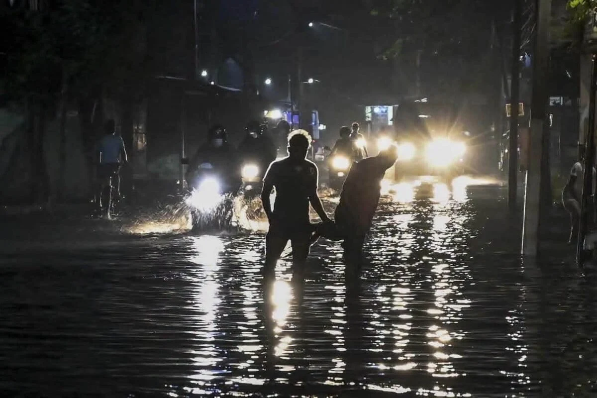
On November 6, a torrential 129-millimeter (5-inch) downpour paralyzed Sri Lanka’s commercial capital within a matter of minutes, turning bustling thoroughfares into churning waterways, stranding thousands of commuters, and submerging countless vehicles. The sudden deluge caught urban dwellers completely off guard, reviving urgent concerns regarding the intersection of rapid climate volatility, aging municipal infrastructure, and unchecked real estate expansion across Colombo’s ecologically vital wetland zones.
For ride-hailing app drivers like Siva Sivasagunthan, the morning storm brought the city to an abrupt standstill. Sivasagunthan recounted how water levels surged around his three-wheeler within minutes, leaving the vehicle partially submerged and turning a routine half-hour transit into an exhausting, two-hour ordeal. Panic rippled through Colombo’s central business districts as offices, commercial centers, and residential neighborhoods struggled to cope with the sudden influx of water.
The Meteorological Context: Intensity Over Volume
While Colombo is no stranger to heavy seasonal precipitation, meteorologists emphasize that the defining characteristic of the November 6 event was not merely cumulative volume, but staggering intensity. Ajith Wijemanna, director of Sri Lanka’s Department of Meteorology, noted that while historical data shows occasional extreme 24-hour rainfall events—such as 493.7 millimeters (19.4 inches) in June 1992 and 440.2 millimeters (17.3 inches) in November 2010—the rate at which rain fell during the recent storm broke normal operational parameters.

According to department readings, the rainfall intensity on November 6 exceeded 120 millimeters (4.7 inches) per hour, with local rain gauges in specific sectors registering upward of 135 millimeters (5.3. inches) within a single hour. "We believe that the main cause of flooding was the high intensity during a short period of time, such as an hour, which was similar to a gushing downpour," Wijemanna explained.
Compounding this meteorological severity is a technological deficit within the nation’s forecasting infrastructure. Wijemanna pointed out that Sri Lanka currently lacks advanced forecasting tools, such as a Doppler weather radar system, which would allow meteorologists to issue high-precision weather alerts with adequate lead time. Once pending radar installations become fully operational, agencies hope to bridge this critical information gap, providing urban authorities and residents with actionable warnings before storms peak.
Straining an Ancient Grey Infrastructure
The urban flooding has placed intense scrutiny on Colombo’s archaic drainage systems. Designed and constructed approximately a century ago, the city’s sewer and stormwater networks were engineered to operate independently under vastly different climatic and demographic realities.
Deepika Wijethilake, deputy director of engineering for drainage design at the Colombo Municipal Council (CMC), explained that the legacy stormwater network was built to handle a maximum capacity of roughly 30 millimeters (1.18 inches) of rainfall per hour. When confronted with rates exceeding 100 to 135 millimeters per hour, the system experienced catastrophic pressure, resulting in slow drainage and widespread surface pooling. Furthermore, the proliferation of modern paved surfaces and concrete developments across the urban landscape has progressively stripped the city of natural soil permeability, exacerbating surface runoff.

In response to the crisis, Prime Minister Harini Amarasuriya instructed local government authorities, including the Department of Irrigation and divisional secretariats, to execute emergency clearance operations across the city’s network of canals and drainage channels. Municipal teams subsequently identified and targeted 60 critical choke points where blocked drains and accumulated debris severely impeded the natural evacuation of floodwaters. Remedial short-term efforts have focused on clearing dense undergrowth, dredging silt deposits, and removing solid waste clogging primary waterways, particularly in densely populated sectors like Dematagoda. Looking ahead, the CMC is drafting long-term engineering blueprints for upgraded drainage architectures capable of withstanding precipitation intensities exceeding 100 millimeters per hour.
Real Estate Boom and the Degradation of Natural Buffers
Beyond the limitations of concrete drainage networks, environmental experts argue that the systematic degradation of Colombo’s natural hydrological buffers is the underlying driver of its worsening flood vulnerability. Situated in a low-lying coastal plain downstream of the Kelani River basin, Colombo is designated as a RAMSAR-accredited wetland city. These ecosystems serve as critical ecological sponges, absorbing excess rainwater, temporarily storing it, and gradually recharging local groundwater tables.
However, a booming real estate market has placed immense pressure on these delicate suburban environments. A 2025 study titled Shifting Grounds, published by the Colombo-based nonprofit Centre for a Smart Future (CSF), investigated the environmental tensions arising from commercial and residential development in suburban enclaves like Thalangama, Kaduwela, Malabe, and Thalawathugoda. The report revealed that developers frequently market these projects under the banner of "green living," leveraging the aesthetic and ecological appeal of adjacent wetlands, rice fields, and peri-urban landscapes to drive property demand. Consequently, these areas have witnessed annual property price spikes of 30% to 40%.
Despite capitalizing on the proximity of these natural assets, developers have largely failed to implement nature-positive building practices. Anushka Wijesinha, co-founder and director of CSF, criticized the superficial integration of nature into modern real estate marketing. "This is a very sensitive wetland complex. They are able to leverage on the wetland to create demand and price premia, but hardly ensure that their projects are nature-positive, which is problematic," Wijesinha stated. He emphasized that the ecological value of these wetlands is fundamentally unaccounted for in prevailing real estate prices or municipal licensing fees.

Economic Stakes and the Need for Ecosystem Valuation
The implications of urban flooding extend far beyond temporary traffic gridlock and localized property damage. Wijesinha noted that Colombo and the broader Western Province generate over 45% of Sri Lanka’s gross domestic product (GDP). The region serves as the nation’s primary hub for international logistics, commerce, and supply chain connectivity. Consequently, recurrent inundations present a tangible macroeconomic risk to the country’s national competitiveness.
To underscore the financial necessity of preserving natural infrastructure, experts point to historical economic valuations, such as a landmark 2003 IUCN study on the Muthurajawela wetland, a coastal peat bog near Colombo. The study demonstrated that the ecosystem services provided by natural wetlands—chiefly flood attenuation and water purification—save the national economy billions of dollars that would otherwise be required to construct and maintain artificial flood-control infrastructure.
Chethika Gunasiri, an environmental scientist specializing in urban sustainability, warned that the Colombo Wetland Complex (CWC)—which currently retains approximately 37% of the city’s incoming rainwater—is shrinking rapidly. Encroachments, land reclamation, and biological invasions by species such as the pond apple (Annona glabra) have converted critical wetlands into terrestrial land, severely compromising their water-retention capacity. Out of the original expanse, only about 20 square kilometers (7.7 square miles) of wetlands remain within the complex. Gunasiri stressed that restoring these green patches and integrating them into a cohesive urban flood management plan is non-negotiable for long-term climate resilience.
Pathways Forward: Sustainable Urban Design and Blended Finance

To avert future crises, urban planners and environmentalists are urging Colombo to adopt forward-thinking, nature-based adaptation strategies modeled after global urban centers. Gunasiri pointed to Copenhagen’s celebrated Cloudburst Management Plan as a viable blueprint, suggesting the integration of urban rain gardens, retention ponds, and bioswales along streets and sidewalks. Such installations would naturally filter and redirect stormwater runoff into the ground and municipal drainage systems, reducing the reliance on purely mechanical interventions.
Addressing the financial deficit required to implement these sweeping reforms remains a paramount challenge. CSF’s Wijesinha advocates for the establishment of a dedicated "adaptation and resilience fund" tailored for local government authorities. This financial mechanism could pool resources from national budgets, bilateral climate grants, multilateral development banks, philanthropic organizations, and earmarked development taxes levied on commercial real estate projects. Without such structural financial provisioning, municipal bodies will remain perpetually underequipped to upgrade roads, redesign drainage grids, and secure the ecological integrity of Colombo’s remaining wetlands against the escalating threats of a changing climate.