The meteoric rise of South Korea stands as one of the most remarkable geopolitical and cultural phenomena of the twenty-first century. While China’s rapid economic expansion dominated global headlines for decades, South Korea has achieved something arguably more pervasive: unprecedented global soft power reach. Across the English-speaking world and beyond, Western consumers routinely drive South Korean automobiles, consume Korean cuisine, listen to Korean pop music, and stream Korean cinematic and television productions. This deep cultural familiarity often breeds a deceptive sense of understanding among international travelers. Yet, just a generation ago, the prevailing outsider perspective on the nation could be summed up by a popular, lighthearted T-shirt pun: South Korea’s got Seoul.
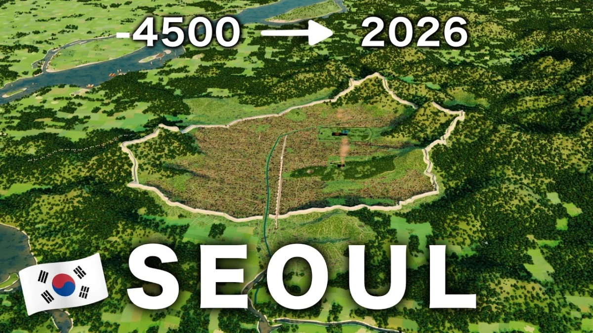
For expatriates and long-term observers who have lived within the metropolis, the transformation of Seoul into a focal point of global fascination has been profound. A striking illustration of this phenomenon is a viral 3D-animated time-lapse video created by Latos Charts, which has rapidly accumulated over 1.2 million views. The visualization charts the historical evolution of Seoul across six and a half turbulent millennia, revealing a narrative of resilience, rapid urbanization, and structural reinvention.
Historical Foundations and the Pre-Modern Era
The visual timeline demonstrates that Seoul did not exist for the vast majority of Korean civilizational history, mirroring the nascent political formations of the peninsula itself. The modern geopolitical division between North and South Korea bears historical echoes of the ancient warring kingdoms that once vied for dominance before unification was achieved through a succession of ruling states. This historical trajectory culminated in the five-hundred-year rule of the Joseon Dynasty, an epoch that serves as the predominant setting for contemporary historical K-dramas.
Widely regarded as the direct institutional and cultural predecessor to modern-day South Korea, the Joseon Dynasty era is compressed into just two minutes of the Latos Charts time-lapse. During this period, Seoul—then known as Hanyang—was established and shaped by traditional geomantic principles, nestled strategically among protective mountain ranges. Its urban footprint largely defined the northern boundaries of the modern city, specifically the territory situated north of the Han River.
Post-War Destruction and the Miracle on the Han River
Until the 1970s, the urban landscape south of the Han River was largely undeveloped agricultural land. The subsequent rise of Gangnam—a district whose name literally translates to "south of the river"—exemplifies the aggressive, top-down state planning that characterized South Korea’s post-war recovery. Following the devastating conclusion of the Korean War in 1953, the nation embarked on an accelerated trajectory of economic development often referred to as the "Miracle on the Han River."
Approximately eight minutes into the 3D visualization, the historical timeline shifts dramatically to reflect this post-war industrial push. High-rise apartment complexes, known locally as apateu danji, begin to proliferate across the geography at an unprecedented pace. This rapid urbanization provided essential modern housing for a burgeoning middle class, though the uniform architecture frequently evokes stark impressions among Western observers. To some international critics viewing the city through architectural photography, these dense residential clusters are sometimes mischaracterized as futuristic dystopias.
Urban planners and municipal analysts, however, offer a more nuanced appraisal. Alongside its dense housing developments, Seoul boasts world-class infrastructure, exemplified by its highly efficient and expansive subway network—a transit system frequently lauded by international urban studies groups, such as the creators of the Not Just Bikes documentary series.
Centralization and National Identity
To fully comprehend modern South Korea, urban historians and sociologists argue that one must first grasp the sheer primacy of its capital. Seoul occupies a position of centralization within the national framework that far exceeds that of Tokyo within Japan or Paris within France. Economically, culturally, and politically, South Korea is deeply centralized around its capital region, prompting observers to note that contemporary South Korea does not merely possess Seoul; to a significant degree, South Korea is Seoul.
This hyper-concentration has driven national economic output and technological innovation, cementing the country’s status as a global hub for semiconductors, automotive manufacturing, and digital technology. However, this centralization also presents structural challenges, including intense regional economic disparities, skyrocketing real estate costs within the capital, and demographic pressures stemming from declining birth rates—challenges that the national government continues to address through policy interventions and regional development initiatives.
Broader Implications and Future Outlook
The evolution of Seoul from a fortified dynastic capital to a hyper-connected global megacity encapsulates the broader trajectory of South Korea’s emergence on the world stage. As the nation’s international influence continues to expand, cultural analysts suggest that global familiarity with Seoul will transcend surface-level tropes and puns, yielding a deeper appreciation for the complexities of Korean history and urban development. In a country whose modern history has repeatedly defied conventional expectations, the ongoing transformation of its capital remains a testament to rapid adaptation and enduring national resilience.