
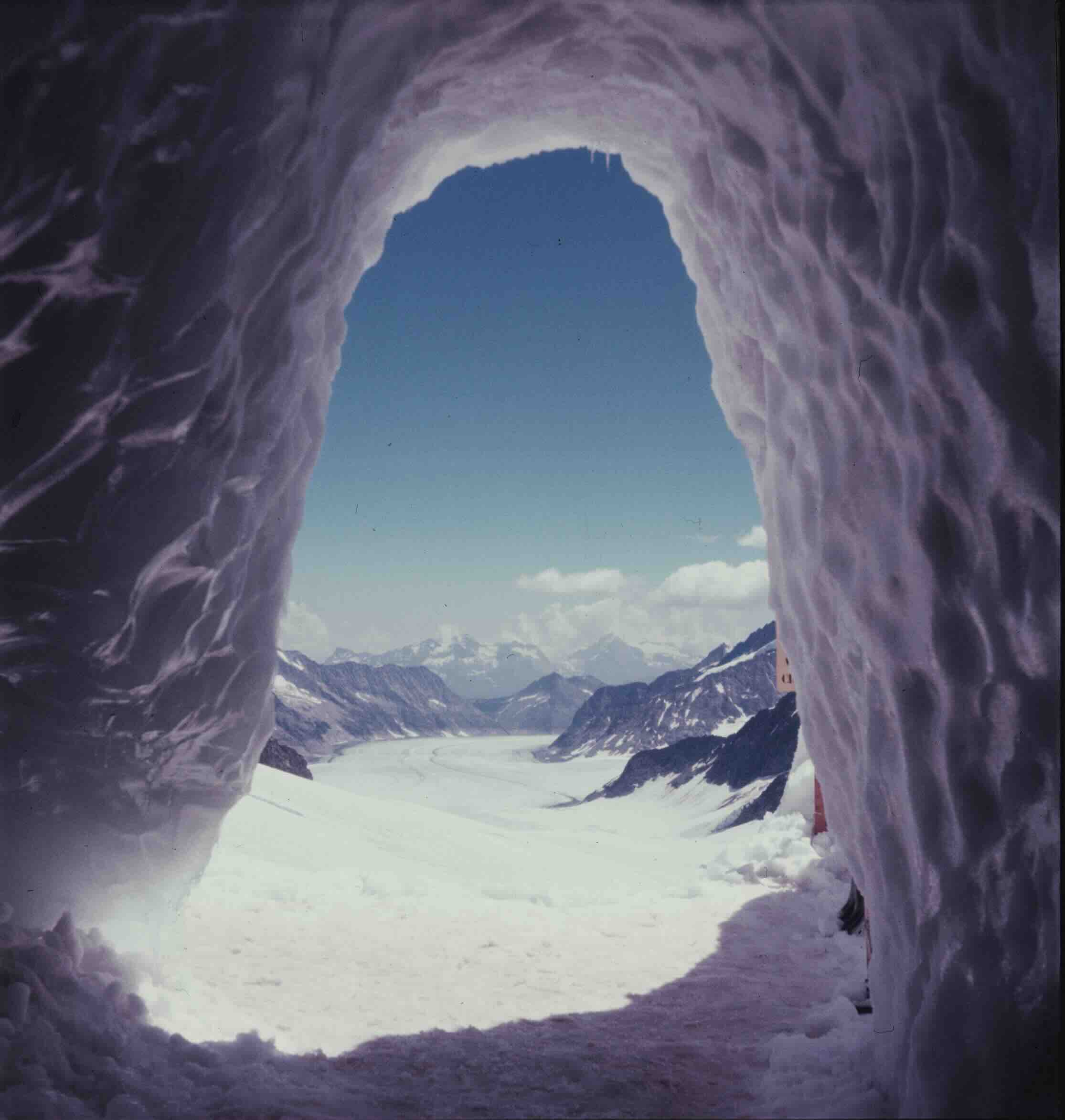
Global cryospheric monitoring has long relied on macro-level assessments, aggregating roughly 275,000 individual glaciers worldwide to measure overall volume loss, cumulative melt rates, and contributions to global sea-level rise. However, field research conducted across multiple continents reveals that treating Earth’s ice masses as a uniform global phenomenon obscures the distinct life histories of individual glaciers. Rather than adhering to a single narrative of rapid, uniform recession, Earth’s glaciers are undergoing hundreds of thousands of localized transformations, shaped by unique regional topographies, microclimates, and localized human interactions.
The Macro Perspective Versus Local Realities
From a global perspective, satellite data and aerial surveys present a stark picture of cryospheric decline. Scientists track the accelerated melting of ice fields from Uganda’s Stanley Glacier—where ice retreat alters hydrological patterns linked to local malaria outbreaks—to Iceland’s Breiðamerkurjökull, where retreating ice exacerbates the pressures of modern tourism. Similarly, South Georgia’s Heaney Glacier has receded to expose expansive terrain, unintentionally creating critical habitats for expanding King penguin colonies.
Despite these broad trends, glaciologists emphasize that every glacier operates as a distinct hydrological and geological entity. Localized variables such as avalanching patterns, volcanic activity, seasonal snowfall distribution, and shade dynamics dictate the specific fate of individual ice bodies. Consequently, while the overarching trajectory of global ice volume is downward, regional anomalies demonstrate that localized processes can temporarily reverse or radically alter standard recession models.
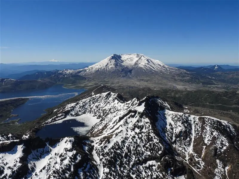
Mount St. Helens: The Unlikely Birth and Evolution of Crater Glacier
Nowhere is the complexity of localized glacier dynamics more apparent than in the Pacific Northwest of the United States. Following the catastrophic May 18, 1980, Plinian eruption of Mount St. Helens, approximately 70 percent of the volcano’s ice mass was destroyed. The eruption obliterated historical glaciers such as the Loowit and Leschi, leaving behind a horseshoe-shaped crater spanning roughly two miles wide, filled with a volatile mix of pumice, ash, and basalt.
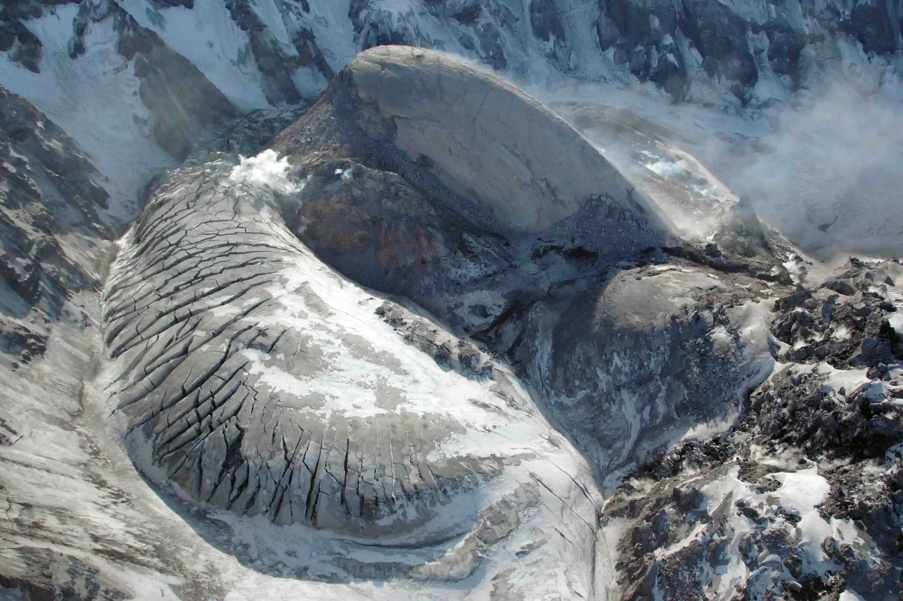
Despite the inhospitable terrain, specific topographic factors created an ideal nursery for new ice formation. Winter storms deposited heavy snowpacks onto the steep internal headwall, which repeatedly avalanched down into the shaded crater floor. By September 1996, glaciologists observed that the accumulated snow and ice had begun to flow—a critical threshold that legally and scientifically defines a glacier as a persistent, moving body of land ice rather than a static snow patch.
Named Crater Glacier, the young ice mass faced an existential test in 2004 when renewed volcanic activity pushed a magma-driven lava dome upward through the crater floor. The emplacement of the lava dome split the glacier into two distinct arms. Driven by intense gravitational pressures, the separated sections deformed, thickened, and accelerated to flow rates between 30 and 60 centimeters per day. Within four years, the moving ice circumvented the obstruction, rejoining to form a unified mass. Between 2009 and 2019, Crater Glacier gained an estimated 13.8 million cubic meters of ice, advancing more than 1,000 feet.
Implications and Hazards of Volcanic Glaciation
While Crater Glacier’s growth remains a notable anomaly against regional trends of glacial retreat, its proximity to an active volcanic vent introduces significant geological hazards. Volcanologists and emergency management officials monitor the ice mass closely due to the potential threat of lahars—rapid, destructive slurries of water, mud, rock, and forest debris triggered when volcanic heat or eruptions melt overlying ice.
Historically, lahars generated during the 1980 eruption devastated downstream infrastructure, destroying bridges, highways, and residential areas. As Crater Glacier continues to evolve within an active volcanic conduit, its ongoing presence underscores the complex intersection between glaciology and public safety in the Cascade Range.
Azerbaijan: The Accelerated Loss and Peak Water Dynamics of the Caucasus
In stark contrast to the growth observed at Mount St. Helens, the Caucasus Mountains illustrate the rapid disappearance of regional ice reserves. In Azerbaijan, glacier coverage has diminished dramatically over the past two decades. Comprehensive scientific assessments indicate that between 2000 and 2020, the nation lost approximately 77 percent of its total glacier area. By 2025, only 14 fragmented glaciers remained, collectively spanning roughly 124 acres—about one-tenth of the ice coverage documented in the 1890s.
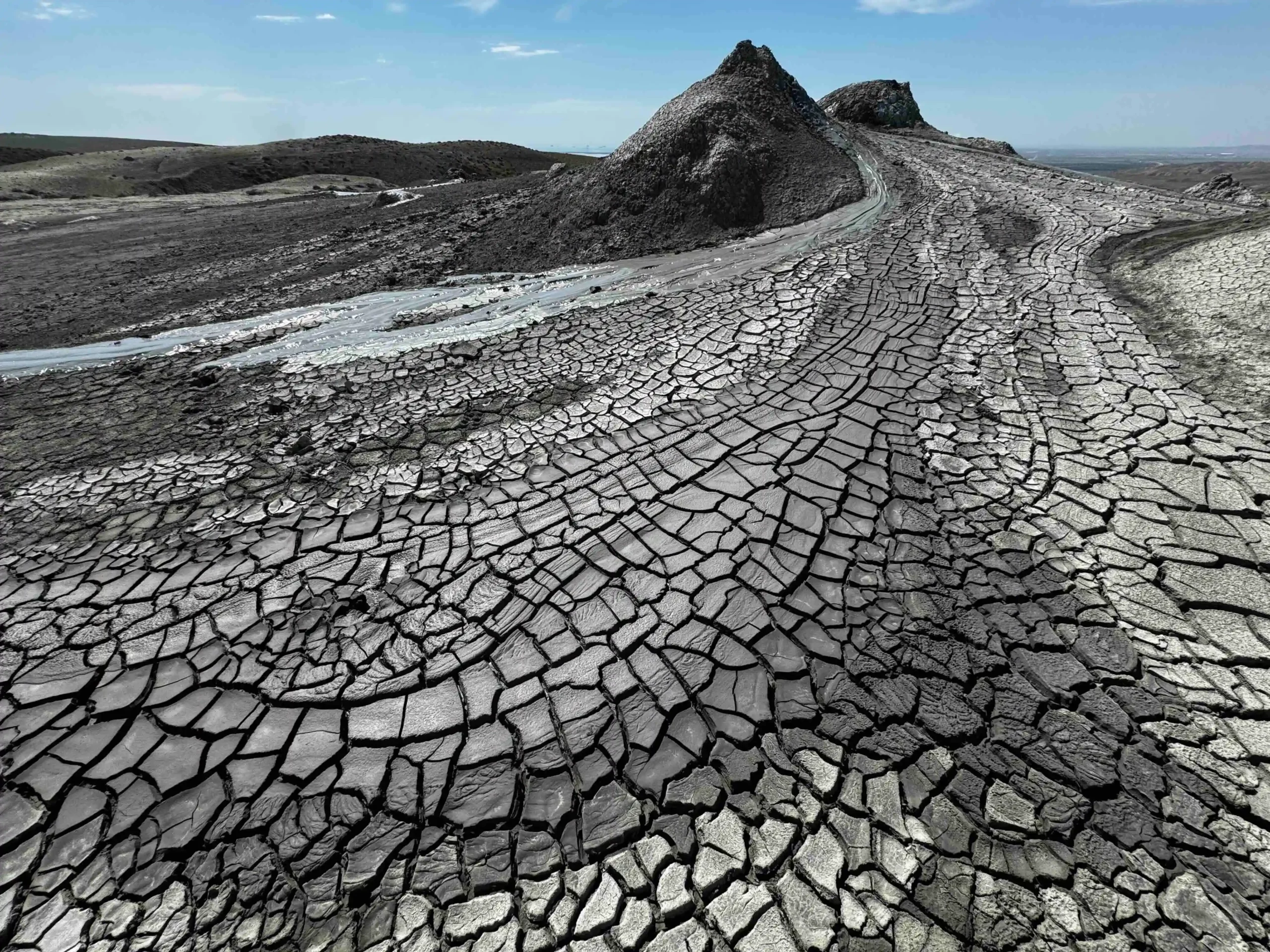
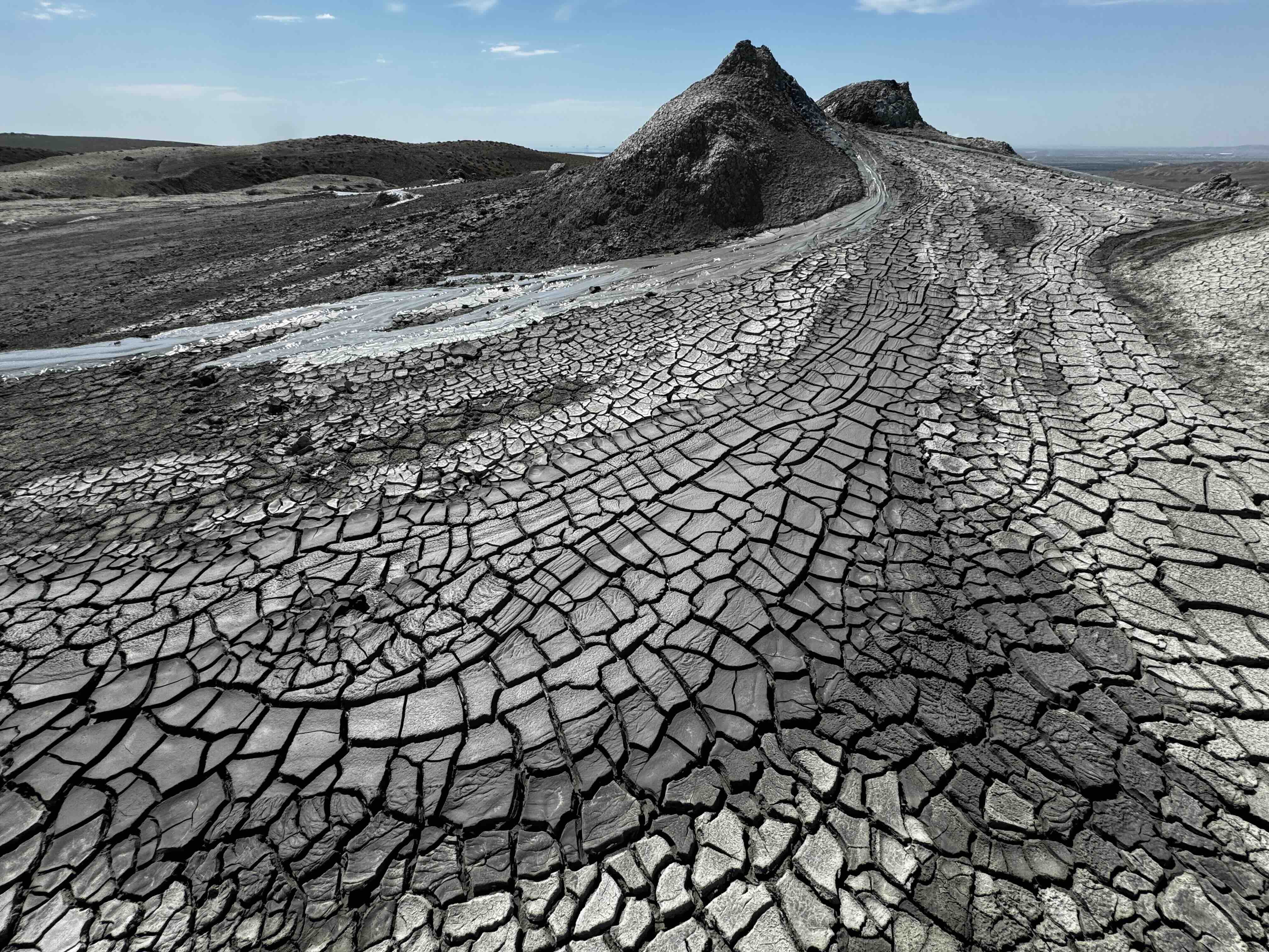
Despite the scale of this loss, public awareness and socio-economic discourse in Azerbaijan largely overlook the retreating ice. Regional development and daily conversation focus heavily on urban expansion, energy production, and tourism initiatives, such as the prominent mud volcanoes in Gobustan State Historical and Cultural Reserve.
However, the rapid melting of Azerbaijan’s remaining high-altitude ice bodies, such as the Tufandag Glacier, carries profound hydrological implications. As glaciers undergo accelerated melt phases, downstream river systems experience temporary increases in water discharge. For instance, observations along the Mahmuddara River, which originates below the Tufandag Glacier, indicate rising water levels corresponding with increased glacial recession.
This phenomenon, known in hydrological science as "peak water," occurs when a disappearing glacier yields its maximum possible meltwater contribution. While the resulting runoff temporarily bolsters agricultural irrigation, domestic water supplies, and regional farming operations—particularly for wheat, fruit, and vegetable production—it represents a finite resource. Once the ice reserves pass the peak water threshold, runoff diminishes significantly, threatening long-term water security for agricultural communities dependent on predictable glacier-fed water systems.
Japan: The Discovery and Fading Existence of the Northern Alps Glaciers
Further east, the mountain ranges of Japan provide additional insight into the delicate balance governing cryospheric survival. Historically, standard glaciological models assumed that environmental conditions east of Russia’s Kamchatka Peninsula were too warm to support glaciers. Although the Sea of Japan region experiences some of the heaviest seasonal snowfall on Earth, supporting an extensive winter recreation economy, regional temperatures and lower mountain elevations were previously thought to preclude the year-round persistence of flowing ice.
This scientific consensus shifted following exhaustive geodetic and radar-based investigations conducted by researchers Kotaro Fukui, Hajime Iida, and Tomoyoshi Kosaka. Utilizing advanced ground-penetrating radar and precise mapping techniques, the research team analyzed perennial snow patches located in the Northern Japanese Alps within Toyama Prefecture.
Their findings confirmed that the Gozenzawa, Sannomado, and Komado snow patches were actively deforming and flowing under their own weight, classifying them officially as active glaciers. Subsequent analysis confirmed that Kuranosuke, long cataloged merely as a permanent snow patch, exhibited measurable movement of approximately 3 centimeters per year, driven by layers of ancient ice radiocarbon-dated to roughly 1,700 years old.
Scientific and Cultural Significance of Newly Identified Glaciers
The formal identification of active glaciers in Japan highlights gaps in global inventory mapping and underscores the sensitivity of localized microclimates. These glacial features survive due to exceptional winter snow accumulation combined with favorable local topography, including steep, north-facing cirques that provide deep shade during summer months.
Nevertheless, these newly recognized ice masses are already experiencing rapid degradation. Rising regional temperatures driven by climate change have accelerated mass loss across the Northern Japanese Alps, pushing Kuranosuke and neighboring ice bodies into an intermediate state between active glaciers and stagnant snow patches.
This transition carries cultural resonance. For over a millennium, Mount Tateyama has served as a revered spiritual landscape, celebrated in classical poetry, such as eighth-century verses by Ōtomo no Yakamochi, for its enduring summer snowpacks. While the physical disappearance of these glaciers appears increasingly probable within the current century, the cultural and historical documentation of the mountain’s cryospheric history ensures that their legacy will persist within local heritage and scientific literature alike.