
The American Southwest is currently grappling with a severe and dual-faceted climate paradox: unprecedented, destructive downpours battering a region historically defined by arid conditions, even as its primary water arteries face long-term depletion. Over the past several weeks, a series of ferocious, moisture-laden storms have inundated communities across Arizona, New Mexico, Utah, and Colorado. These deluges have claimed at least four lives, destroyed critical infrastructure, and delivered two to three months’ worth of typical precipitation in a matter of days. While the sudden influx of water provides a momentary and dramatic infusion of moisture to parched landscapes, it arrives with catastrophic force, highlighting the vulnerability of human infrastructure built for scarcity rather than sudden, overwhelming abundance.
Climatologists tracking the meteorological events point to a powerful convergence of factors, chief among them an exceptionally strong El Niño event currently unfolding in the Pacific Ocean. This band of anomalous warm water is injecting immense amounts of energy and atmospheric moisture into global weather patterns, creating the primary ingredients for extreme precipitation events across the southern tier of the United States. While meteorologists emphasize that storms of this magnitude can occur outside of El Niño years, the alignment of atmospheric moisture, ocean temperatures, and regional weather systems makes such occurrences far more probable and severe under current climatic conditions.
Chronology of a Crisis: From Late-October Deluges to Recent Floods
The escalation of extreme weather in the Southwest began unfolding in earnest in late September and reached a critical phase during a historic weather event in late October. A slow-moving atmospheric river tapped into the abnormally warm waters of the Pacific, directing a relentless conveyor belt of moisture directly toward the southern Rockies and desert Southwest.
In late October, a catastrophic storm system dropped up to eight inches of rain across higher elevations in Colorado over a compressed four-day window. The torrential downpours shattered historical state records, triggering massive mudslides, washing out mountain passes, and stranding residents in towns such as Sedona and Pagosa Springs. Rivers that were already running high from previous autumn rains quickly breached their banks, transforming normally docile desert arroyos and mountain streams into raging torrents of water and debris.
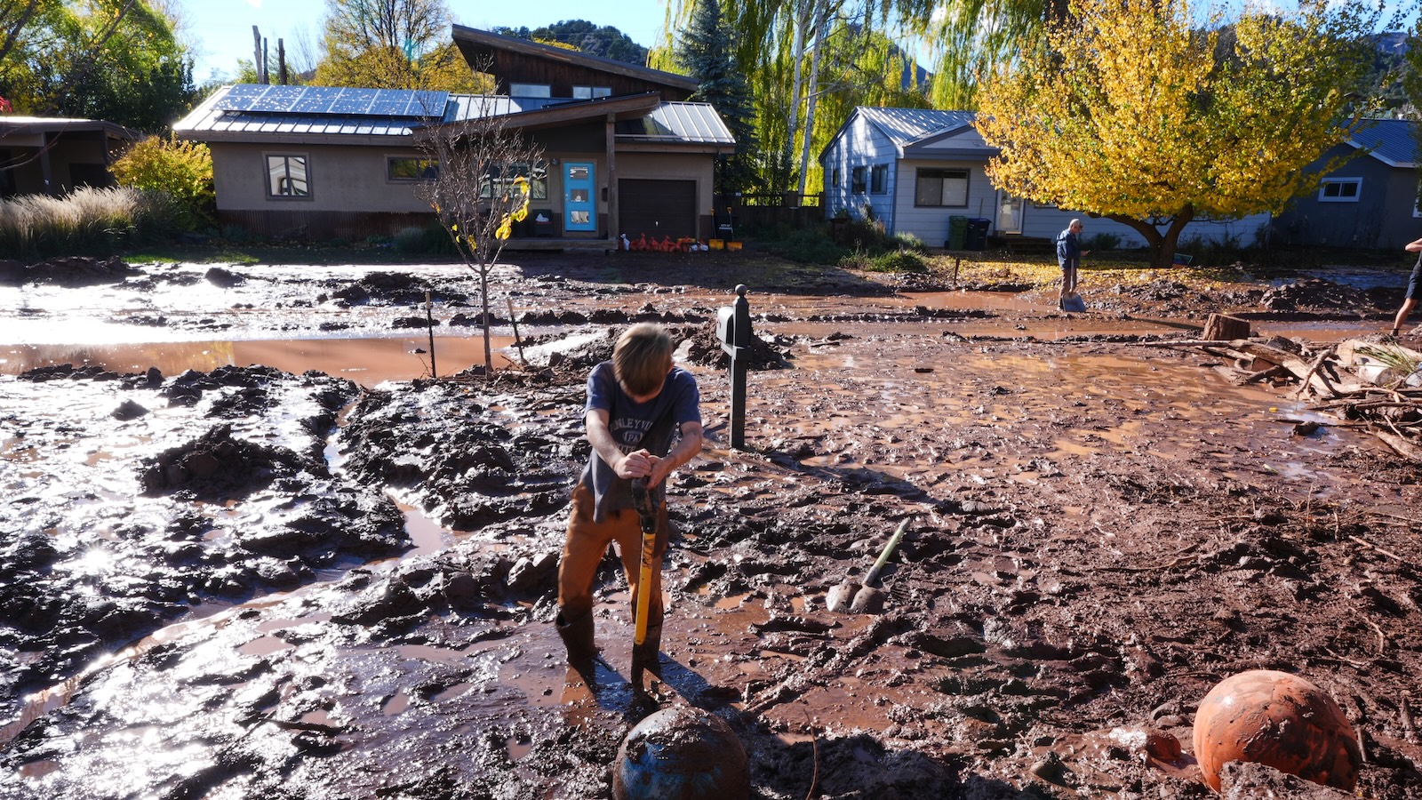
The saturation of regional soils set the stage for subsequent disasters. When a ferocious follow-up storm struck the region just days later, the landscape had lost its capacity to absorb any additional moisture. Instead of soaking into the ground, the new rainfall instantly turned into runoff, exacerbating river flooding and overwhelming municipal drainage systems. In Clovis, New Mexico, weather stations recorded an astonishing 28.84 inches of rain since September 20—a stark contrast to the city’s historical average of just 3.3 inches for the same period. The compounding nature of these successive systems left emergency management personnel scrambling to execute swift-water rescues and clear blocked transportation corridors across four states.
The El Niño Driver and Global Climate Context
The intensity of these autumn deluges is closely linked to sea surface temperatures in the equatorial Pacific Ocean. According to seasonal outlooks published by the National Oceanic and Atmospheric Administration (NOAA), the current El Niño event is tracking as one of the strongest on record. Even a slight elevation in Pacific water temperatures can release vast amounts of thermal energy into the atmosphere, fundamentally altering jet stream configurations and storm tracks across North America.
This atmospheric disruption has had far-reaching consequences across multiple weather basins. Notably, the powerful upper-level winds generated by the Pacific warmth created hostile atmospheric conditions for tropical development in the Atlantic basin, effectively suppressing hurricane activity during a period when storms typically peak. NOAA data highlights that the 2026 Atlantic hurricane season shattered records for the latest first-named hurricane by nearly a month, producing only a single tropical cyclone by late autumn instead of the historical average of six.
Conversely, the same thermal dynamics that quieted the Atlantic supercharged activity in the eastern Pacific, which produced 10 hurricanes this season. Climatologists note that the oceans have absorbed more than 90 percent of the excess heat generated by human activities since the industrial era. This global ocean warming provides an unprecedented reservoir of heat and water vapor, feeding atmospheric rivers and intensifying regional precipitation events worldwide. Russ Schumacher, the state climatologist and director of the Colorado Climate Center at Colorado State University, emphasized that the connection between these relentless Southwestern storms and the ongoing El Niño pattern is unmistakable, noting that each successive system has funneled extraordinary amounts of water vapor directly into the region’s complex topography.
Implications for the Colorado River Basin and Long-Term Drought
For decades, the overriding narrative in the American Southwest has been one of relentless dryness, shrinking reservoirs, and escalating water scarcity driven by climate change and surging populations. The Colorado River basin, which sustains roughly 40 million people and millions of acres of agricultural land across seven U.S. states and Mexico, has seen its two largest storage facilities—Lake Powell and Lake Mead—hover perilously close to dead pool levels.
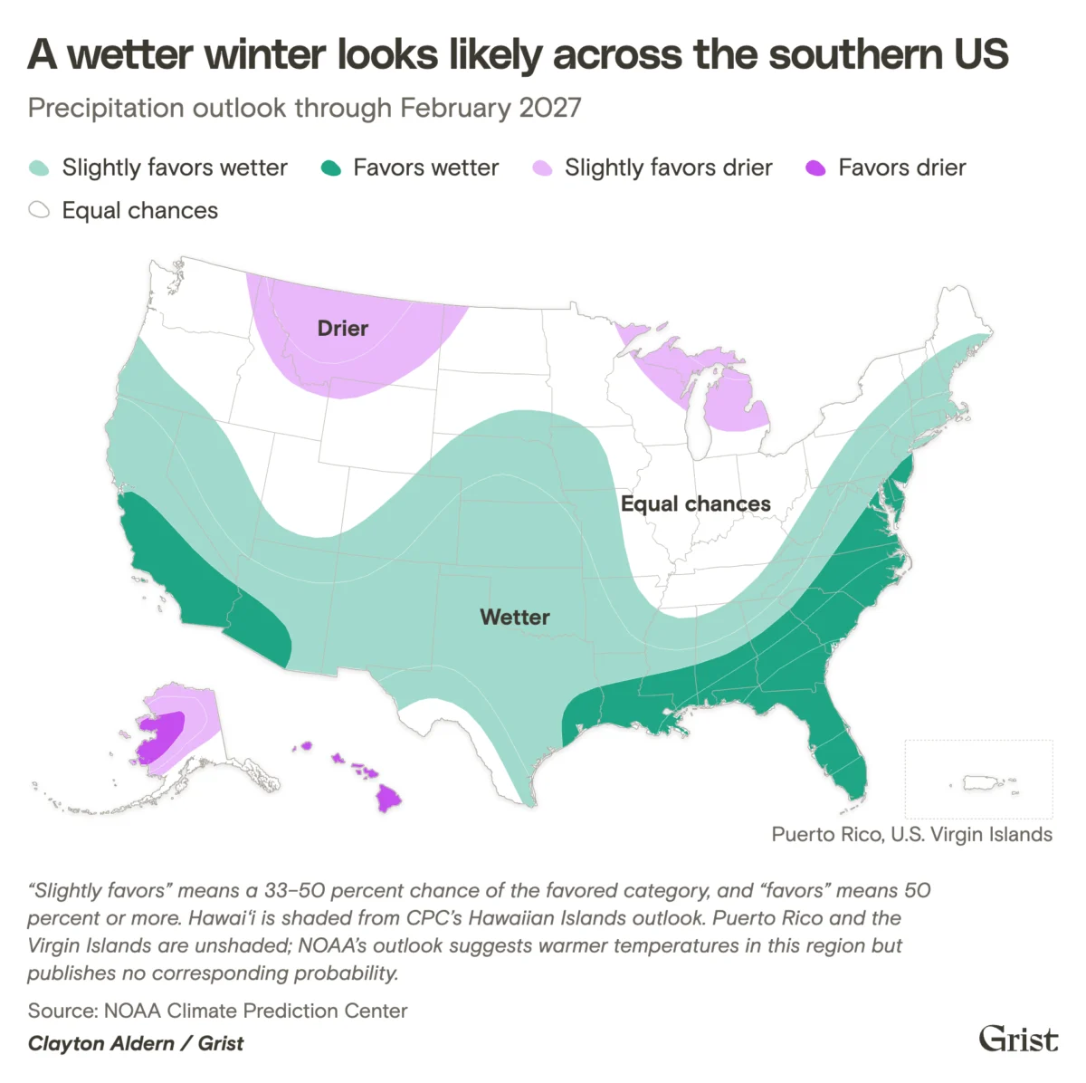
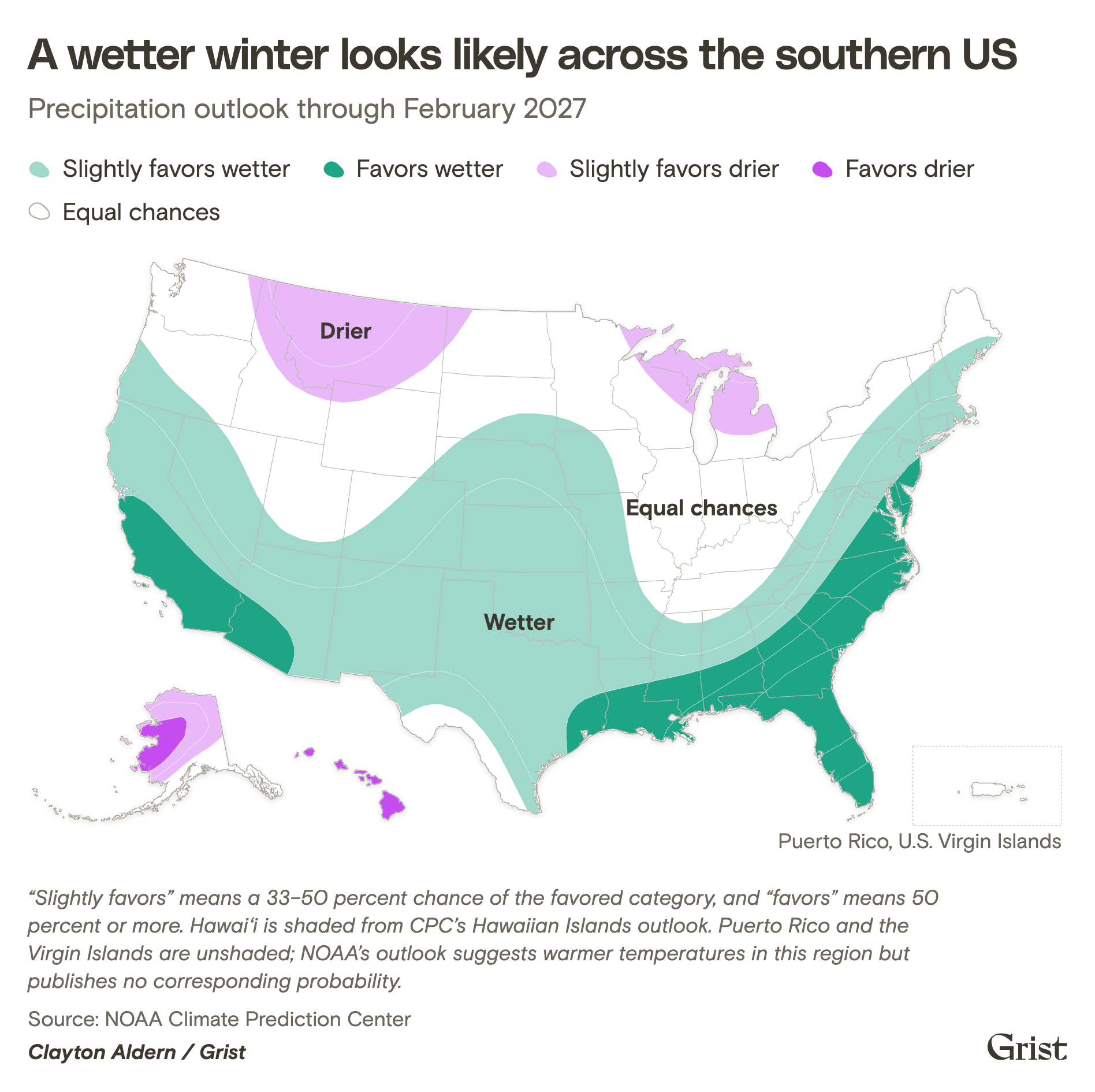
The heavy autumn rainfall and NOAA’s winter projections of a wetter-than-average season across the southern U.S. offer a nuanced outlook for the region’s long-term water security. According to NOAA’s seasonal drought outlook, precipitation associated with the current El Niño is expected to improve or entirely end drought conditions across much of the Southwest, the Southern Plains, and the Southeast.
However, water resource experts caution that surface runoff from sudden, intense rainstorms is fundamentally different from the slow-melting snowpack that historically sustained the Colorado River system. Rainwater rushes rapidly into major river channels, making it exceedingly difficult for regional infrastructure to capture and store efficiently without triggering catastrophic downstream flooding. Furthermore, while the recent deluges provide a temporary boost to localized soil moisture and minor reservoirs, climatologists stress that they are mathematically insufficient to reverse the multi-decade decline of the broader Colorado River system. Restoring Lake Powell and Lake Mead to historical operating levels would require years of above-average precipitation and sustained, deep snowpacks in the Rocky Mountains.
The Wildcard of Winter Snowpack
As the region transitions from autumn into the heart of winter, water managers are turning their attention to high-elevation snow accumulation. Mountain topography plays a critical role in the hydrology of the Southwest; snowpack acts as a natural, frozen reservoir that gradually releases water into river systems during the spring thaw, smoothing out the supply curve for downstream cities and farms.
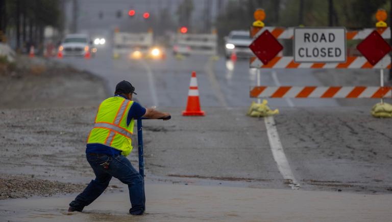
Following a winter that yielded record-low snowpacks across parts of the Colorado Rockies, the region is in urgent need of heavy snowfall. Michael A. Crimmins, a climatologist at the University of Arizona, points out that the Southwest’s rugged topography has always made the region susceptible to flash flooding, noting that prehistoric water movement is evidenced by out-of-place boulders scattered across desert canyons and mountain ranges alike. While snowpack melts gradually and replenishes groundwater and reservoirs sustainably, heavy winter rain on top of frozen or saturated soils can quickly transform mountainous terrain into hazardous flash-flood zones.
Adapting Infrastructure for a Hydro-Climatic Shift
The stark reality of managing water in the 21st-century Southwest requires a paradigm shift. Historically, regional water agencies focused almost exclusively on importing water from distant rivers and engineering channels to move stormwater away from populated areas as quickly as possible. The increasing frequency of intense precipitation events, amplified by global warming, has rendered that traditional approach obsolete.
Municipalities throughout Arizona and New Mexico are increasingly adopting green infrastructure strategies to capture, slow, and infiltrate stormwater locally. In Tucson, urban planners have invested heavily in green infrastructure initiatives, utilizing engineered basins, permeable pavements, and native vegetation to intercept runoff, recharge shallow aquifers, and mitigate urban heat island effects simultaneously. These techniques transform stormwater from a destructive nuisance into a valuable municipal resource.
As the American Southwest navigates the complex and often destructive manifestations of a super El Niño winter, policymakers and water managers face a delicate balancing act. They must harness the incoming moisture to alleviate persistent, structural drought while simultaneously fortifying communities against the immediate, high-impact hazards of extreme flooding and infrastructural strain.