The global chocolate industry faces an unprecedented crisis, driven by extreme weather events, crop diseases, and soaring demand that pushed New York cocoa futures to a historic high of approximately $12,900 per metric ton in December 2024. While this commodity boom has incentivized farmers in West Africa and parts of West Africa to clear pristine native forests to maximize planting acreage, a contrasting trend is unfolding across the Brazilian Amazon. Rather than razing virgin timber, cocoa expansion in states like Pará and Rondônia is overwhelmingly repurposing long-abandoned and heavily degraded pasturelands.
According to comprehensive new mapping data released by Embrapa, Brazil’s state-run agricultural research agency, the geographic footprint of cacao cultivation in Pará—the nation’s leading producer—grew by roughly one-third between 2022 and 2024. The total cultivated area expanded to 116,436 hectares, translating to approximately 287,700 acres, distributed across 61 distinct municipalities. Crucially, geographical tracking reveals that 96% of the newly mapped cacao in Pará and an astounding 98% in Rondônia are situated on lands that were deforested prior to 2020. This precise localization offers a built-in economic and regulatory advantage, ensuring that Brazil’s rising cocoa sector aligns seamlessly with tightening international environmental standards, most notably the European Union’s landmark Deforestation Regulation (EUDR).
A Decade of Remote Sensing and Ground-Truth Mapping
The realization that Brazil could expand its cocoa production without harming the Amazon rainforest is the result of years of meticulous scientific tracking. The methodology traces its lineage back to TerraClass, a collaborative remote sensing initiative established alongside Brazil’s space agency, INPE, which monitors the post-deforestation land-use dynamics of the Amazon basin. Under the leadership of Adriano Venturieri, a remote sensing specialist at Embrapa Amazônia Oriental based in Belém, researchers initially sought to answer a fundamental data gap: a decade ago, nobody precisely knew where commercial cocoa was actually growing in Pará.
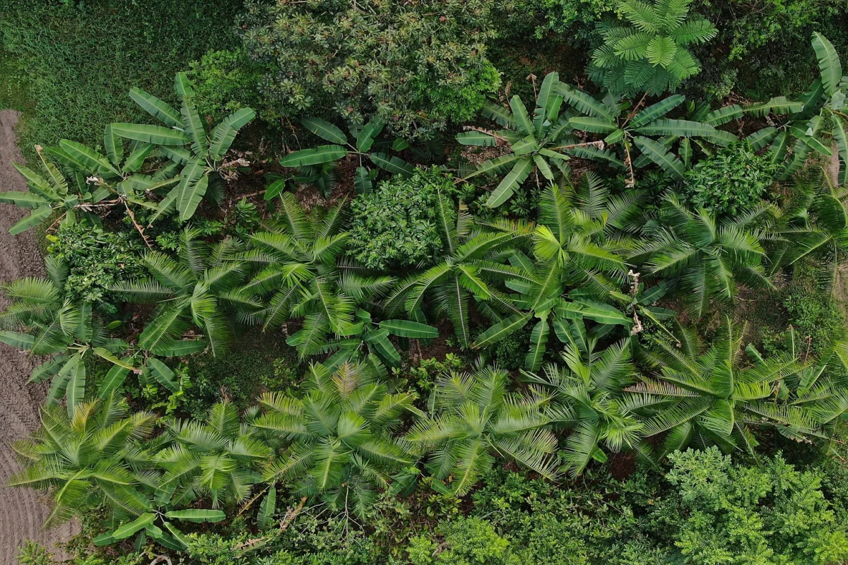
When Venturieri’s team first examined satellite imagery of the region, the initial data proved baffling. Tracts of land that resembled secondary forest cover frequently materialized as commercial cocoa plantations integrated into sophisticated agroforestry systems, locally known by the Portuguese acronym SAF. These systems deliberately intercrop cocoa beneath a dense canopy of taller native trees, which naturally regulate pests, suppress disease, and provide smallholder farmers with diversified income streams from secondary harvests like açaí, bananas, cupuaçu, and Brazil nuts.
To verify these ambiguous satellite signatures, researchers embarked on extensive ground-truth campaigns. Venturieri collaborated directly with field technicians from CEPLAC, the federal cocoa agency, and Emater, Pará’s rural extension service. They traveled deep into remote agrarian communities, presenting printed satellite imagery to local farmers to manually identify and delineate active plots. By 2021, the initiative scaled significantly when Embrapa partnered with NASA ecologist Naiara Pinto to transition the analytical framework to Google Earth Engine.

The initial nationwide baseline results, published in 2022 using historical data spanning 2004 to 2020, mapped nearly 70,000 hectares of cocoa in Pará. The data confirmed that 89% of the crop had replaced former pasturelands cleared before the 2008 cutoff date stipulated under Brazil’s Forest Code. Furthermore, 99.5% of these plantations sat safely outside protected zones, Indigenous territories, and Quilombola traditional lands.
Scaling Up: The 2026 Mapping and Regional Expansion
Building upon the success of the initial baseline, CocoaAction Brasil—a public-private initiative operating under the umbrella of the World Cocoa Foundation—agreed to fund an updated and expanded study in 2025. Venturieri’s team incorporated advanced radar technology alongside high-resolution multispectral imagery gathered from multiple satellites, transitioning their predictive models to SITS, an open-source analytical software developed by INPE.
The finalized results were formally presented in August at the ExpoCacau 2026 trade fair held in Bahia state. The updated survey encompassed roughly 121,000 hectares across Pará and Rondônia. In Pará alone, the harvested area surged by 33.26% over a two-year window, climbing from 87,309 hectares in 2022 to 116,436 hectares in 2024. The structural makeup of these operations highlights a deeply rooted family-farming economy: roughly 84.6% of Pará’s cocoa properties span five hectares (12 acres) or less.
For the first time, the mapping initiative expanded into Rondônia, a southwestern Amazonian state with no prior comprehensive cocoa baseline. Despite logistical challenges, field surveys identified 5,340 hectares of cacao distributed across 51 municipalities, predominantly managed by smallholders.
Vítor Stella, technical coordinator at CocoaAction Brasil, notes that the empirical mapping provides the international supply chain with an unprecedented level of transparency. Tracing agricultural commodities in the Amazon is notoriously difficult; supply chain managers often navigate up to 150 kilometers of unpaved dirt roads branching off the Trans-Amazonian Highway just to reach a single-hectare family farm. By leveraging precise satellite mapping and geospatial verification, the industry can definitively prove the exact origin and transit path of its raw materials.
Economic Drivers and the Regulatory Compliance Shield
The rapid acceleration of cocoa cultivation in the Brazilian Amazon has been heavily propelled by unprecedented global market forces. Following severe crop failures, systemic viral diseases, and erratic weather patterns across West African powerhouses Côte d’Ivoire and Ghana, international cocoa markets experienced a severe shock. Futures prices on the New York exchange skyrocketed from an average of roughly $3,300 per metric ton in 2023 to an all-time record high of approximately $12,900 in December 2024. Although prices have since retreated to roughly $5,800 per ton, they remain nearly 75% higher than historical baselines.

Despite these lucrative price incentives, Brazilian farmers have overwhelmingly bypassed pristine forest clearance in favor of degraded pastures. Venturieri points out a simple economic reality: clearing old-growth forest demands intensive capital and labor, whereas Pará contains millions of hectares of exhausted, unproductive pastureland where establishment is significantly cheaper and faster.
This economic pragmatism intersects perfectly with shifting international trade legislation. The European Union remains the world’s largest importer of cocoa, absorbing roughly 60% of total global trade. The EU Deforestation Regulation (EUDR), scheduled to apply fully to large market operators, strictly prohibits the importation of commodities grown on land deforested after December 31, 2020.
Venturieri’s presentation at ExpoCacau 2026 explicitly framed the Brazilian Amazon’s land-use history as a regulatory "compliance shield." Within Pará, approximately 80% of mapped cacao sits on land cleared prior to 2008—categorized by researchers as a secure "safe zone"—while 17% occupies land cleared between 2009 and 2020. Only 3.9% falls into the post-2021 "risk zone." In Rondônia, the corresponding figures are 92%, 6%, and 2%, respectively. This historical land-use profile effectively positions Brazilian cocoa as instantly compliant with European trade mandates, offering a stark contrast to other global frontiers where surging prices continue to drive aggressive deforestation.
The Shift Toward Full-Sun Monocultures
Despite the long-standing dominance of traditional agroforestry, the recent price boom has catalyzed a noticeable shift in cultivation methods. Among the roughly 29,100 new hectares planted in Pará between 2022 and 2024, 63% were established as full-sun monocultures, while only 37% adopted traditional agroforestry systems. Full-sun systems feature a single crop cultivated intensively across large areas without a shade canopy.
Agronomists note that full-sun management offers higher initial yields per individual tree. While a cocoa tree grown in an agroforestry environment typically yields approximately 900 grams of dried beans annually, a tree exposed to direct sunlight can produce between 2.5 and 3 kilograms. However, this increased productivity comes with significant trade-offs: full-sun monocultures are markedly more vulnerable to fungal pathogens, insect pests, and extreme weather fluctuations, while locking farmers into single-crop economic dependency. Conversely, Rondônia exhibited the opposite trend, with 62% of its new cocoa utilizing agroforestry models preferred by local smallholders.
For researchers observing the socioeconomic realities on the ground, the rationale behind the full-sun shift is strictly practical. Farmers are navigating immediate economic pressures and seeking to maximize household revenue streams amid shifting cost-of-living realities, rarely prioritizing long-term ecological resilience over near-term income generation.

Productive Conservation and Future Projections
Industry leaders maintain that Brazil possesses ample agricultural capacity to scale production significantly without threatening native ecosystems. Current average yields across Brazil hover around 350 kilograms per hectare—half of the historical productivity rates achieved during the 1970s, when national yields averaged 700 kilograms per hectare. Experts emphasize that basic soil remediation, improved genetics, and proper pruning techniques could easily double or triple existing yields on land already in production.
This potential forms the foundation of Brazil’s national Inova Cacau 2030 plan, formalized as official state policy in May. The strategic roadmap aims to elevate national production above 400,000 metric tons annually, bring 120,000 new hectares under sustainable management frameworks, and achieve 70% supply chain traceability by the end of the decade. The overarching objective is to establish Brazil not merely as a high-volume exporter, but as the global benchmark for sustainable cocoa origin.
Researchers stress that the physical space available for this agricultural transition is vast. Collaborative studies conducted by Venturieri and anthropologist Eduardo Brondízio have identified approximately 13 million hectares of degraded land in Pará alone that are suitable for sustainable agricultural conversion. The state’s entire existing cocoa footprint could comfortably fit inside less than 1% of that available pool. Across the wider Amazon basin, MapBiomas data indicates that pasturelands cover approximately 56 million hectares.
As global chocolate consumption continues to rise, the Brazilian model demonstrates that agricultural growth and environmental preservation are not mutually exclusive. By leveraging historical land-use data, prioritizing degraded pasture restoration, and enforcing strict supply chain transparency, Brazil is positioning its cocoa sector to capture premium international markets while keeping the surrounding Amazonian rainforest intact.