
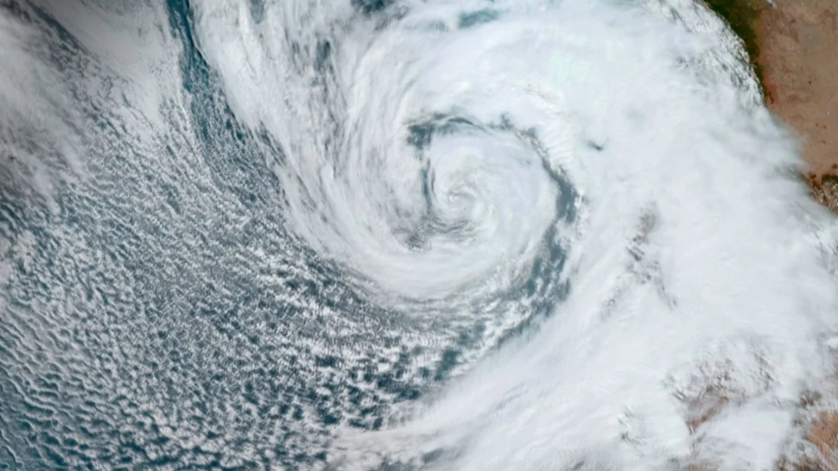
Pacific Hurricane Polo startled meteorologists and emergency management officials alike following an astonishing display of rapid intensification that saw the weather system transform from a standard tropical storm into a ferocious Category 5 hurricane in less than 24 hours. The meteorological event, which unfolded on Tuesday, September 22, pushed maximum sustained winds to an astonishing 180 mph (290 km/h) before the storm began a gradual weakening trend.
As of the National Hurricane Center’s (NHC) updated advisory issued on Wednesday, September 23, Polo has been downgraded slightly to a potent Category 4 hurricane. Drifting parallel to the southwest coast of Mexico, the storm continues to present a significant atmospheric hazard. Although current predictive models indicate that Polo will likely bypass a direct landfall along the Mexican mainland, authorities remain on high alert. The storm’s massive wind field and abundant moisture are projected to unleash torrential rainfall, threatening vulnerable coastal communities with life-threatening flash floods, dangerous mudslides, and violent marine conditions.
The Meteorological Anatomy of Rapid Intensification
The explosive growth of Hurricane Polo serves as a stark reminder of the volatile nature of modern tropical meteorology, particularly within the Eastern Pacific basin. Rapid intensification—defined by the NHC as an increase in a tropical cyclone’s maximum sustained winds by at least 35 mph (56 km/h) in a 24-hour period—pushed absolute boundaries during Polo’s lifecycle. In a fraction of that timeframe, the storm jumped multiple categories on the Saffir-Simpson Hurricane Wind Scale.
Atmospheric scientists point to a confluence of ideal environmental triggers that fueled Polo’s unprecedented spike in power. Sea surface temperatures in the Eastern Pacific off the coast of Mexico were notably elevated, providing a deep reservoir of thermal energy necessary to feed the burgeoning convective engine. Additionally, local atmospheric conditions featured low vertical wind shear, a factor that typically rips developing storms apart. Instead, the absence of shear allowed Polo’s inner core to organize rapidly, establishing a distinct, pinhole eye and an impenetrable ring of intense thunderstorms that define major hurricanes.
Chronology of a Weather Anomaly
The timeline of Hurricane Polo’s dramatic lifecycle highlights the dizzying speed at which contemporary high-end storms can evolve, complicating forecasting and disaster preparedness efforts.
Early Phase and Genesis: The disturbance that would eventually become Polo began as a tropical depression far out in the open waters of the Pacific. Fueled by warm waters, the system steadily organized, crossing the threshold into a named tropical storm early in the week.
The 24-Hour Explosion: Throughout the day on Monday, September 21, and into the early hours of Tuesday, September 22, the storm underwent a textbook rapid intensification phase. Satellite imagery captured the system tightening and deepening at an alarming rate. By Tuesday afternoon, reconnaissance aircraft and satellite estimates confirmed that Polo had achieved the rare and elite status of a Category 5 hurricane, sustaining peak winds of 180 mph (290 km/h).
The Downgrade and Trajectory Shift: By Wednesday, September 23, the storm encountered slightly cooler waters and minor shifts in atmospheric moisture, prompting a natural weakening cycle. The NHC officially downgraded Polo to a Category 4 hurricane. Despite the drop in wind speeds, the storm retained its structural integrity, maintaining a large and dangerous footprint as it crept northwestward parallel to the Mexican coastline.
Supporting Data and Scale of the Storm
To understand the sheer destructive potential of Hurricane Polo, meteorologists analyze a variety of quantitative metrics gathered by satellite constellations, hurricane hunter aircraft, and oceanographic buoys.
At its peak as a Category 5 system, Polo’s 180 mph (290 km/h) winds placed it in the highest echelon of global tropical cyclones, capable of inflicting catastrophic structural damage to even well-built structures, uprooting trees, and rendering entire regions uninhabitable for weeks or months. Central pressure within the eye plummeted to extreme lows, a characteristic hallmark of intense kinetic energy conversion.
Even after dropping to a Category 4 system, Polo’s winds remained catastrophic, easily surpassing the 130 mph (209 km/h) threshold. Furthermore, tropical-storm-force winds extended outward for tens of miles from the center, generating massive swells that began pounding the coastline of southwestern Mexico long before the core of the storm reached its closest point of approach. These swells pose a severe hazard to maritime navigation, local fishing fleets, and beachgoers, creating life-threatening rip currents and high surf conditions along multiple states’ coastlines.
Official Responses and Preparedness Measures
In light of the sudden threat posed by Hurricane Polo, civil protection authorities, local government agencies, and federal disaster response teams in Mexico swung into action immediately following the NHC’s upgraded alerts.
Emergency management officials across the states lining the southwestern coast issued a series of high-level warnings. Local municipalities activated emergency operation centers, positioning rescue equipment, medical supplies, and heavy machinery in strategic zones susceptible to isolation via washouts and landslides. Shelters were opened in pre-designated schools and civic buildings, with local police and national guard units assisting in the voluntary and mandatory evacuation of residents living in low-lying coastal areas, river valleys, and steep hillsides prone to slope failures.
"While current forecasts keep the core of Hurricane Polo offshore, residents must not lower their guard," noted a regional civil protection spokesperson in an emergency broadcast. "The sheer volume of rain associated with this system is our primary concern. Mountainous terrain combined with torrential downpours invariably leads to deadly mudslides and flash floods."
Port authorities along the path of the storm implemented immediate closures, ordering commercial vessels, cruise ships, and local watercraft to seek safe harbor or steer clear of the hazardous operational zones. Airports in select coastal regions also monitored conditions closely, preparing for potential flight cancellations as outer rainbands and gusty winds swept onshore.
Broader Impact and Climate Implications
The emergence of a storm with the explosive characteristics of Hurricane Polo inevitably sparks broader conversations among climatologists regarding the behavior of tropical cyclones in a warming world. While individual weather events cannot be exclusively attributed to a single global trend, scientists observe that rising global ocean temperatures provide an expanded thermal baseline, increasing the probability and frequency of rapid intensification events.
Storms that rapidly ramp up in strength just offshore present a unique nightmare scenario for forecasters and coastal populations alike. Traditional preparation timelines, which often rely on days of gradual strengthening to mobilize resources and evacuate populations, are compressed into hours. This dynamic leaves emergency responders with a narrow window to secure infrastructure and protect human life.
Furthermore, slow-moving or parallel-tracking major hurricanes like Polo often result in prolonged exposure to heavy rainfall. As the atmosphere warms, it holds significantly more moisture, supercharging the precipitation potential of tropical systems. Consequently, even when a storm avoids making direct landfall, the secondary hazards—specifically inland flooding and saturated earth giving way to landslides—frequently account for the majority of property destruction and loss of life.
Looking ahead, meteorological agencies will continue to track Polo as it charts a northwestern course into the cooler waters of the open Pacific, where it is ultimately projected to weaken further into a tropical storm and eventually dissipate. However, the legacy of Polo’s rapid ascension to Category 5 status will endure as a case study in modern meteorological bulletins, underscoring the urgent need for advanced forecasting models, resilient infrastructure, and proactive disaster preparedness in an era of intensifying weather extremes.









Leave a Reply